


May 1st
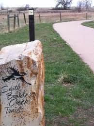 City of Boulder’s Open Space and Mountain Parks (OSMP) Department will begin seasonal area closures to protect grassland ground-nesting birds beginning Thursday, May 1.
These closures will be in effect until July 31.
No designated trails will be closed as part of this protective measure.
The areas closed for grassland ground-nesting birds are:
Both sides of the Greenbelt Plateau Trail from Community Ditch Trail to the Greenbelt Plateau Trailhead on state Highway 128. Dogs will be allowed on the Greenbelt Plateau only if they are on leash (the trail is normally voice-and-sight control);
The area north of Community Ditch Trail and west of state Highway 93;
The area north of the Flatirons Vista North Trail and west of Highway 93 on top of the mesa;
The area north of the South Boulder Creek West Trail, east of the Bluestem Connector and south of Shanahan Ridge (dogs are prohibited in this area year-round).
Dog regulations on both the Community Ditch and Doudy Draw trails will remain voice-and-sight control.
For a variety of reasons, grassland bird populations in North America have declined sharply in the last several decades. Three species that OSMP monitors – Grasshopper Sparrows, Horned Larks and Lark Sparrows – have suffered at least a 50-percent population decline in the last 40 years, according to the National Audubon Society. The closures OSMP will implement Thursday are important in protecting these species’ habitats by keeping people and their pets away as the birds attempt to nest.
Please help OSMP protect these species and other ground-nesting birds by respecting the closures. Trespass violations can result in a summons with penalties up to 90 days in jail and/or a $1,000 fine.
Source: City of Boulder
Oct 17th

The department anticipates having more than 50 percent of its trail system open on Saturday when dozens of volunteers will help the department complete rebuilding projects on the Doudy Draw trail complex south of Boulder. The volunteer assistance – which will build on the work of OSMP trail crews – will enable the department to open more miles of trails.
“We’ve made significant strides in reopening Boulder’s prized trails, but we know we have much more work ahead of us,” said Mike Patton, director of the city’s Open Space and Mountain Parks Department. “Our approach has been to reopen trails that serve the broadest segment of the community and to leverage the immense generosity of volunteers to help us rebuild our community’s trail system.”
When the recent flooding subsided, OSMP conducted a preliminary assessment that found it caused significant or severe damage to 77 miles of trails. Floodwater also caused some damage to dozens of miles of other trails. The department then diverted its staff – including trail crews, seasonal employees and full-time employees – to provide immediate trail access to neighborhoods and areas across Boulder.
Since the September flood, OSMP has opened 70 miles of trails, along with 20 trailheads. It has also opened climbing areas on the First and Third Flatirons, and it is working with volunteers from the Flatirons Climbing Council and Rocky Mountain Rescue Group to assess local climbing access areas and explore additional openings.
As first responders and local climbers help OSMP survey climbing areas, hundreds of other volunteers continue to help the department rebuild and restore important drainages and ecosystems. In recent weeks, OSMP has held 15 volunteer projects, which have helped the department make progress in opening more trails. Volunteers have also assisted OSMP by providing guided hikes, which give area residents insights about how the flood has impacted the city’s open space system. More than 600 people have participated in the guided hikes.
“We’re fortunate to have so many volunteers helping us to rebuild,” Patton said. “We’ve been inspired by their hard work and willingness to help the community.”
In the coming weeks, OSMP anticipates opening the following trails and areas:
By the end of 2013, OSMP expects to open:
While OSMP is making progress opening many trails and trailheads, some trails will remain closed to the public after Jan. 1. These trails have become eroded and buried in debris, and will require significant repairs. In addition, their closure will help reduce the creation of new social trails, which causes adverse environmental impacts. Areas that will likely remain closed past the beginning of the year include:
“We understand the desire to get back on the trails,” Patton said. “We’re doing everything we can to provide our community with exceptional recreational opportunities as we continue our commitment to ensure long-term resource protection.”


