


Sep 8th
Top Hat Supply has thrived at the same downtown Boulder location for 45 years. Top Hat is among the oldest downtown businesses in Boulder. Excelling at customer service, product quality and cleaning solutions. We are proud to be a great resource for the people and businesses of Boulder County and beyond. Not so glamorous, but we love what we do. Helping people find the right product to meet their needs, without waste and with the most efficiency and least harm to our environment. We have solutions, green products, 45 years of experience, free same day delivery and a tremendous product line for such a small space.
 1729 Pearl Street
Boulder, CO 80302
(303) 443-3547
tophatsupply@aol.com
![]()

Feb 6th
Rangers responded to:
• A report of an injured on the Baseline Trail. The hiker slipped on the ice, attempted to brace herself with her arms and potentially broke her right wrist. Rangers worked with both Boulder Fire and AMR on this call.
• A report of a suicidal party in the Flagstaff area. The suicidal party stated that he wanted to jump off of one of the Flatirons to his Dad who then called 911. Rangers working with BCSO to find the party at Crown Rock and helped with his arrest and transport to hospital.
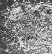
mountain lions bury prey and return to it often to feed
• A report of a mtn lion cache in the area of 800 Willowbrook. Mtn lion was seen pawing the home owners sliding glass door. Rangers worked with CPW on this call.
• A report of an injured hiker on the Mesa Trail who had slipped and fell on the ice, hitting his head. Rangers worked with Boulder Fire on this call.
• A report of a vehicle fire at Cathedral Park. The fire started because of an electrical issue with the car. Rangers worked with Boulder Fire and Denver Water on this call.
• A report of a hiker getting kicked in the head by a cow at the North Teller Trailhead.
The hiker saw a cow giving birth and thought it was in distress and went over to look and help. The cow promptly kicked her, loosening some of the hiker’s teeth.
• A report of an active criminal trespass happening off of Eldorado Springs Dr. OSMP Rangers were first to respond and detained the suspect. The suspect, later identified as Senator Mark Udall’s son, had broken into three vehicles and stolen a small amount of cash. The suspect was arrested and drug paraphernalia was found to be in his possession.
• A wildfire at Buckingham Picnic area. The fire started in a logjam and heavy equipment had to be used to get to the interior of the fire. Jay Jones brought in a backhoe to help clear the debris. Rangers worked with Lefthand Fire on this call, it is unknown how this fire was started.
• A report of an injured sledder at Chautauqua, Rangers worked with AMR on this call.
Dec 10th
The Boulder Police Department is investigating a series of high-end bicycle thefts dating back to early 2013. Police are aware of numerous stolen road and mountain bikes. At this time, none of the bicycles has been recovered. Although the thefts occurred in Boulder, the victims are nationwide, as many were visiting Boulder during the spring and summer months.
Investigators believe the thefts are related based on the pattern (modus operandi) of the suspect. The majority of the bikes were attached to vehicles either by a roof mount, a hitch rack or a rack mounted in truck beds. The thief or thieves used bolt cutters and/or wire cutters to defeat cable and u-locks to remove the bicycles from vehicles which were parked on downtown streets and parking garages, and from neighborhoods like Goss Grove and Frasier Meadows.

During the course of the investigation, detectives have recovered dozens of bike accessories that include:
· Pumps
· Tools
· Saddle bags
· Cyclometer
· Other generic bike accessories
Photos of many of the recovered accessories are attached and detectives would like to communicate with anyone who may recognize the items and/or who has had a bicycle stolen in the manner and from locations mentioned above. Anyone who has been assigned a current case file number is asked to provide that information to police when calling.
Anyone with information about this investigation is asked to contact Detective Craig Beckjord at beckjordc@bouldercolorado.gov or 303-441-3336. Those who have information but wish to remain anonymous may contact the Northern Colorado Crime Stoppers at 1-800-222-TIPS (8477) or 1-800-444-3776. Tips can also be submitted through the Crime Stoppers website at www.crimeshurt.com. Those submitting tips through Crime Stoppers that lead to the arrest and filing of charges on a suspect(s) may be eligible for a cash reward of up to $1,000 from Crime Stoppers.
— CITY–


